3D Visualisation - Urban Project
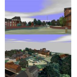
- Our Client, an Architect, needed a survey of the site which included the adjacent Buildings. It was intended that the perspective views of the development were to be developed from different locations. Using a 3D model rendered using real life photos, we were able to move through the model to the required area and capture the view in a real perspective. - The model was used to see how the development would fit into the surrounding environment. The advantage of using a computerised system is that it helps us to provide the planners with a number of alternative views on request.Visit the Mining Surveys (UK) Ltd website for more information on 3D Visualisation - Urban Project

