3D Point Cloud Data Surveyors Near Me
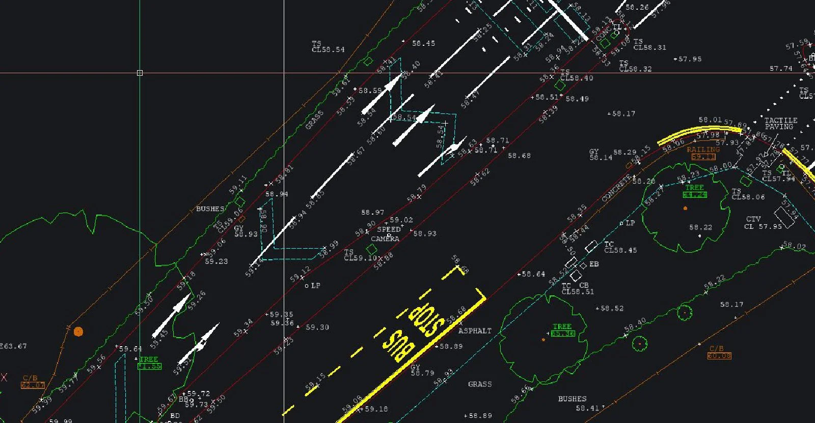
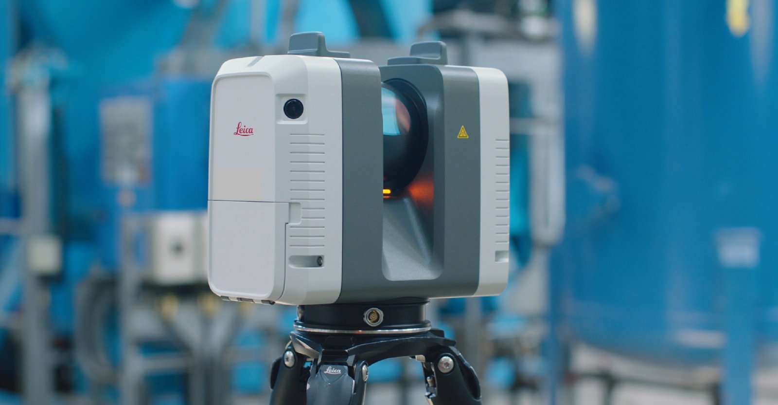
3D Point Cloud Data Surveyors Near Me3D laser scanning is high definition surveying; a method of collecting high density spatial data sets in a fraction of the time taken by traditional systems.
Visit the SJ Geomatics Ltd website for more information on 3D Point Cloud Data Surveyors Near Me
ENQUIRY FORM