Accurate Underground Utility Mapping And Tracing Services UK
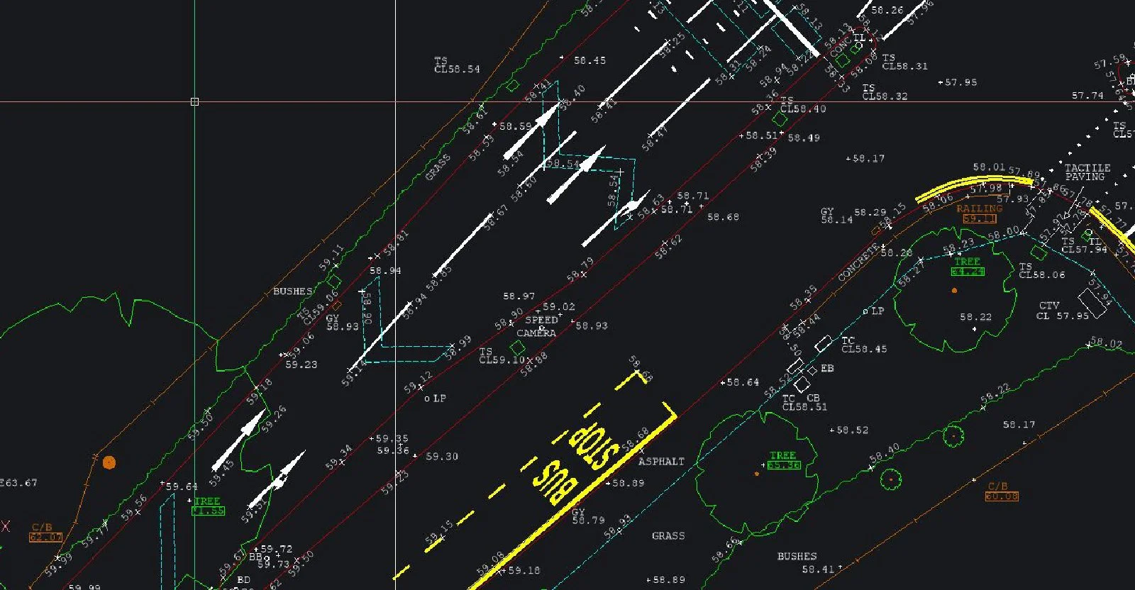
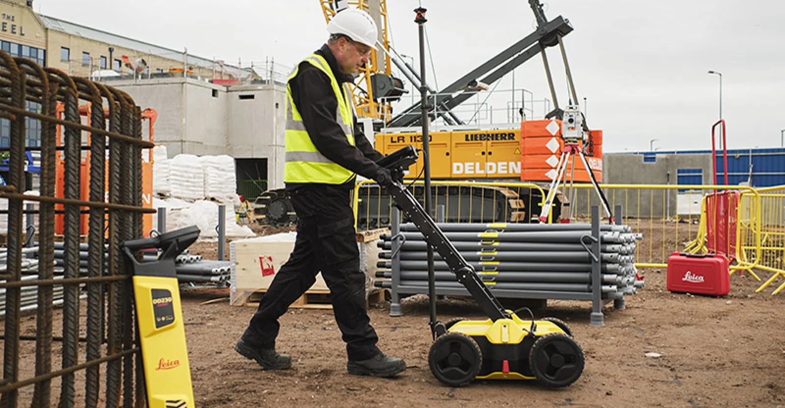
Accurate Underground Utility Mapping And Tracing Services UKSJ Geomatics delivers expert underground detection surveys across the UK using advanced GPR, RFL, GPS and positioning-station methods. We precisely map buried pipes, cables, manholes and utilities with depth and type information, helping contractors and developers safely plan excavations, avoid service strikes, and integrate utility data into CAD or GIS.
Visit the SJ Geomatics Ltd website for more information on Accurate Underground Utility Mapping And Tracing Services UK
ENQUIRY FORM